


Live maps Satellite view

Description of Live maps Satellite view
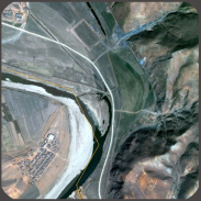
Live Maps Satellite View is an application that enables users to explore satellite imagery of various locations around the globe. It allows for real-time viewing of specific addresses and landmarks, making it a useful tool for individuals interested in geography, travel, or navigation. Available for the Android platform, users can easily download Live Maps Satellite View to access its array of features.
This application provides a user-friendly interface that simplifies the process of searching for locations. Users can enter specific addresses or points of interest, and the app retrieves satellite images that offer a detailed view of the selected area. The imagery is often updated frequently, providing a glimpse of changes in landscapes and urban environments over time. For those who enjoy exploring new areas or revisiting familiar ones, this functionality enhances the user experience.
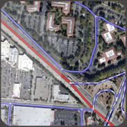
An essential feature of Live Maps Satellite View is its ability to switch between different map views. Users can choose from standard map views, satellite views, or even hybrid views that combine both. This flexibility allows for a more comprehensive understanding of the geography, as users can see not only satellite images but also street names and other geographical markers. Navigating through these views is intuitive, with straightforward controls that facilitate easy transitions.
In addition to viewing satellite images, the app includes features that enhance user interaction with the map. Zooming in and out is seamless, enabling users to focus on specific details or gain a broader perspective of an area. This functionality is particularly useful for users interested in examining particular buildings, parks, or other significant landmarks. By pinching the screen or using on-screen controls, users can easily adjust their view to suit their needs.
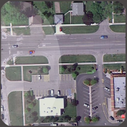
Live Maps Satellite View also offers a search function that allows users to quickly locate specific places. Whether searching for a restaurant, a park, or a historical site, the search tool provides relevant results, which can be viewed in conjunction with satellite imagery. This feature is valuable for those planning trips or looking to explore new neighborhoods, as it offers insights into local attractions and amenities.
For users interested in navigation, the app incorporates features that can assist in finding routes between locations. While it does not provide turn-by-turn directions like dedicated navigation apps, users can visualize the area and determine potential paths. This capability is beneficial for users who prefer to plan their routes based on visual information rather than relying solely on textual directions.
One of the noteworthy aspects of Live Maps Satellite View is its potential for educational use. Students and educators can utilize the app to explore geographical concepts, study urban development, or investigate environmental changes. The access to real-time satellite imagery serves as a practical resource for those looking to enhance their understanding of the world.
The application is designed to be responsive and works well across various Android devices. Users can expect a smooth experience, whether they are using a smartphone or tablet. The app's performance is optimized for different screen sizes, ensuring that users can view detailed satellite images without compromising on quality.
Social sharing features are also integrated into the app, allowing users to share their findings with friends and family. Users can easily capture images of specific locations and share them via social media or messaging platforms. This encourages interaction and engagement, as users can discuss interesting places or plan outings based on shared locations.
Customization options are available, enabling users to personalize their experience within the app. Users can adjust settings related to map views, imagery quality, and other preferences to cater to their specific needs. This level of customization ensures that users can tailor the app to fit their unique requirements.
As a visualization tool, Live Maps Satellite View stands out for its accessibility and ease of use. It serves a diverse audience, from casual users exploring different locations to professionals requiring accurate satellite imagery for work. The app’s functionality supports a wide range of interests, making it a versatile addition to any Android device.
Live Maps Satellite View offers a straightforward yet robust platform for exploring satellite imagery. Its combination of user-friendly navigation, detailed satellite views, and interactive features makes it suitable for both casual exploration and educational purposes. Users can download Live Maps Satellite View to enhance their understanding of geographical locations and enjoy a comprehensive mapping experience.
This application effectively brings the world closer to users, allowing them to observe and engage with their surroundings in a meaningful way.
Live maps Satellite view - Version 1.0
(04-05-2017)
Live maps Satellite view - APK Information
APK Version: 1.0Package: com.livemaps.satelliteviewLatest Version of Live maps Satellite view


 3.55
3.55
 3.17
3.17


Apps in the same category


